


Limits between territories are not the exclusivity of human beings, as most animals do have territorial behaviours. However, political frontiers are what makes us different. Political borders reflect the evolution of populations, identities, cultures and political forces over time. They are artificial lines socially and politically built that move along eras, ideologies and dominant powers. They are not just about keeping competitors away or making sure to have enough hunting and fishing resources to survive (which is what an animal territory is about). Political borders are also symbolic constructions people rely on to build their identity as a group (today we’d say, as a nation).
[Read the second part of this article: What are Borders 2/2]
Borders tell us about the way we divided our world. Understanding them is understanding history, economy, politics and geography at a very global scale.
Let’s begin with 5 simple statements about borders.
- Borders move
- Borders do not match with cultural areas
- Borders can be either man-made or natural landforms
- There are also Water Borders
- Borders go from thin lines to large buffer zones
1. Borders move
There was no need to materialize borders physically at the prehistoric times. Peoples were small groups spread on very large territories, so they were rarely meeting each other and they was no massive conflict over resources and land. Borders are a very imperialist invention that came with the will to possess, conquest, delimit a physical hold on the land (and its inhabitants). They became essential when our relationship with each other became a conflictual one over resources and authority.

Even if we all learnt the World Map with well established borders (since no major changes happen since the Yugoslav Wars in the 1990’s), it’s essential to remember that the world was not always divided that way and that it will continue moving.
Even if we are looking at regional borders, its important to remember that geography moves along with political & economical context. Borders are always human made, so they constantly move & evolve to fit the new established identities.
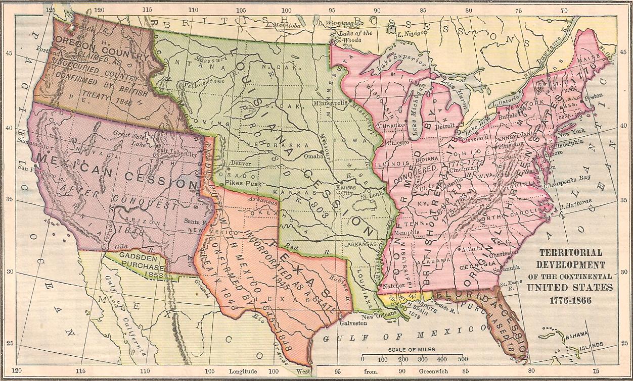
The last country to be born is South Sudan, which became officially a country in 2011. To get an impression of how often the World’s map changes, take a look at the Wikipedia list, it speaks for itself. Notice as well that those changes were far more frequent a couple of centuries ago than now. The nation-state model (more below) is indeed stabilizing after nearly 400 years of existence.
2. State borders do not (always) match with cultural ones
Its also important to remember that political borders do not (always) reflect reflect cultural areas. Our world is dominated by the Nation-State model basically saying that for every cultural identity group (the nation), their is a political legitimate system & associated territory (the state) guaranteeing the sovereignty of the cultural group on this portion of land.
As the Nation-State concept has been invented and imposed by europeans, it does indeed match most of the european cultural areas (and that is after more than 1,000 years fighting & imposing it). However, the cultural map of the world is much more complex and moving than the political one. As you can see on the map below, if we look at just the main religious areas in the world, we can see that they rarely match with states.

Map of religious dominant influences in the world. They are usually large areas that do not match nation-states borders. Some countries are cut in half and put together more than one dominant religion.

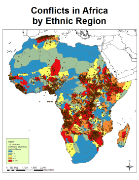
The most striking example is probably african borders. As a fully colonized continent, not a single country in Africa didn’t get to decide the outlines of its borders. The nation-state system was imposed by europeans to fit their conception of how the land should be divided. Basically, Africa has been divided to arrange european countries rivalries, guarantee that african peoples would stay busy fighting each other over sovereignty, and process to the distribution of natural resources for colonial trade.
So, when looking at the two maps above, we see that conflicts location (the brown dots) makes a lot more sense when looking at the ethnic region map than at the nation-state one.
[Read more about Africa Ethnic Map & Conflicts location]
3. Borders can be man-made limits and/or follow landforms outlines
Where the political border split two peoples that used fight each other over land possession, religious beliefs or natural resources ownership, borders tend to be man-made and very visible. They can be a wall, like the 3,000 km wall separating USA from Mexico, the West Bank barrier in Israel, or like the Berlin Wall used to be. They can also be a highly armed line (like the border between Jordan and Israel) where checkpoints with soldiers are succeeding every 5 km.

The US-Mexico border goes on more than 3,000 km and is materialized by a wall and a fence all along.
A lot of countries are delimited from their neighbours by natural landforms like lakes, ridge lines, cliffs or major rivers.
Despite the heavy history between France and Germany, the Rhine River is now drawing a section of the border between the two countries. Between the US and Canada, where territories to delimit was huge, border follows the 45e parallel and goes through 4 of the 5 Great Lakes. In Africa, the border between Tanzania and the Democratic Republic of Congo is passing right in the middle of the lake Tanganyiga.
4. There are also Water Borders
All countries that have a sea border – so countries that are not landlocked – have a 22 nautical miles (41 km) from coast ownership of the waters. It means that you are still in Mexico when 22 miles away from Tijuana, going due west. That limit is shaping what’s called the Territorial Seas. Further than the Territorial Seas is the Exclusive Economic Zone that goes to 200 nautical miles (370 km) from the coasts. Further than that, its the International Waters, where no state has authority over one other.

Every dark blue areas are International Waters. Light blue areas are Exclusive Economic Zones.
Japan borders are only delimited by the outline of the 6,852 islands its made of (and the EEZ around it). Same thing happens with Australia, New Zealand and the 47 other Island Nations UN has counted in the world which do not have immediate neighbours (Haiti, for instance, is an island nation but shares the island with the Dominican Republic. So it has land border as well).
Of course, water borders can’t be materialized. There are no walls, no posts, no fences over the oceans. Here, only the law is the actual guarantee of the border’s existence. Those borders are harder to control. They are more permeable and blurry than land ones.
5. Borders can be thin lines or large buffer zones
Political borders, either following a natural landmark outline or man-made fences, can have a lot of different aspects and sizes. In some areas in the world, where there are no political stakes nor economic disputes, borders can be a simple dotted line, or a sign on the side of the road. One step before, you are in Belgium, the next step you are in France. But you won’t see any immediate changes in the landscape, nor any military presence or fence.

The France-Belgium Border can be nothing more than just a sign on the side on the road. Sometimes you cross it without even noticing!
In more disputed territories, borders can be large buffer areas, delaying and filtering flows from both sides. The border between the two Koreas for instance has taken the shape of a Military Demarcation Line that is the centre strip of the Korean Demilitarized Zone that is approximately 4km wide (2.5 miles). This is, unlike its name suggests, one of the most militarized area in the world where the border is also a frontier between two radically different political systems.

The borders between the two Koreas is one of the most spread and militarized border in the world.
More fun about borders
I strongly recommend this great video that will tell you about the US/Canada border in a very unusual way!
Next article: What are borders? (2/2) will be about the way borders shape also identities, make up new mixing ones and contribute to change the way we define ourselves as nations and as inhabitant of the world. We’ll talk about cosmopolitism & universal philosophies, and wonder if the world could exist without borders.
[Read the second part of this article: What are Borders 2/2]

Pingback: The Hidden Meanings of Maps (1/2) | Pick-Me-Up Tonic